
Garforth topographic map
Interactive map
Click on the map to display elevation.
About this map
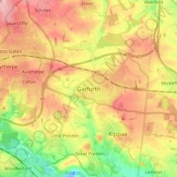
Name: Garforth topographic map, elevation, terrain.
Average elevation: 67 m
Minimum elevation: -20 m
Maximum elevation: 124 m
Other topographic maps
Click on a map to view its topography, its elevation and its terrain.
Tingley
United Kingdom > England > Leeds > Tingley
Tingley, Leeds, West Yorkshire, Yorkshire and the Humber, England, WF3 1UR, United Kingdom
Average elevation: 120 m
Wetherby
United Kingdom > England > Leeds > Wetherby
Wetherby, Leeds, West Yorkshire, Yorkshire and the Humber, England, LS22, United Kingdom
Average elevation: 41 m
Rothwell
United Kingdom > England > Leeds
Rothwell, Leeds, West Yorkshire, England, LS26 0NX, United Kingdom
Average elevation: 54 m