
Coral Bay topographic map
Interactive map
Click on the map to display elevation.
About this map
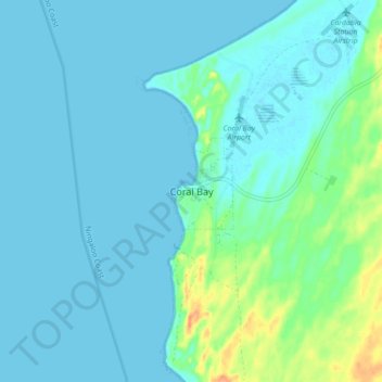
Name: Coral Bay topographic map, elevation, terrain.
Location: Coral Bay, Western Australia, Australia (-23.18368 113.73017 -23.10368 113.81017)
Average elevation: 7 m
Minimum elevation: 0 m
Maximum elevation: 43 m
Other topographic maps
Click on a map to view its topography, its elevation and its terrain.
Bateman Bay
Australia > Western Australia > Coral Bay
Bateman Bay, Mauds Landing - Warroora Road, Lyndon, Coral Bay, Shire Of Carnarvon, Western Australia, Australia
Average elevation: 0 m