
The Common topographic map
Interactive map
Click on the map to display elevation.
About this map
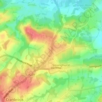
Name: The Common topographic map, elevation, terrain.
Average elevation: 64 m
Minimum elevation: 29 m
Maximum elevation: 112 m
Other topographic maps
Click on a map to view its topography, its elevation and its terrain.
Sissinghurst
United Kingdom > England > Kent > Tunbridge Wells > Sissinghurst
Sissinghurst, Tunbridge Wells, Kent, South East England, England, TN17 2JF, United Kingdom
Average elevation: 66 m