
Rocky Point topographic map
Interactive map
Click on the map to display elevation.
About this map
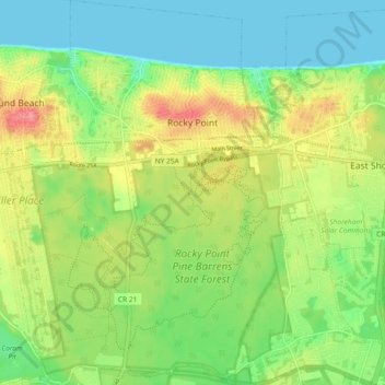
Name: Rocky Point topographic map, elevation, terrain.
Average elevation: 31 m
Minimum elevation: 0 m
Maximum elevation: 77 m
Other topographic maps
Click on a map to view its topography, its elevation and its terrain.
North Patchogue
United States > New York > Suffolk County > Town of Brookhaven
North Patchogue, Town of Brookhaven, Suffolk County, New York, United States
Average elevation: 15 m
East Patchogue
United States > New York > Suffolk County > Town of Brookhaven
East Patchogue, Town of Brookhaven, Suffolk County, New York, 11772, United States
Average elevation: 10 m
Selden
United States > New York > Suffolk County > Town of Brookhaven
Selden, Town of Brookhaven, Suffolk County, New York, 11784, United States
Average elevation: 41 m