
Cleland National Park topographic map
Interactive map
Click on the map to display elevation.
About this map
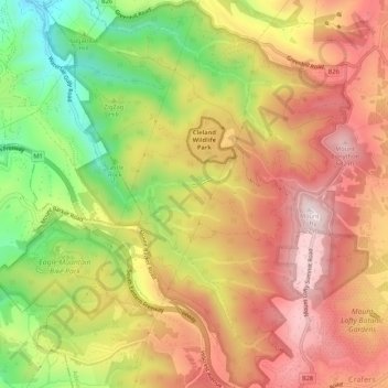
Name: Cleland National Park topographic map, elevation, terrain.
Average elevation: 472 m
Minimum elevation: 173 m
Maximum elevation: 709 m
Other topographic maps
Click on a map to view its topography, its elevation and its terrain.
Crafers
Australia > South Australia > Crafers
Crafers, Adelaide Hills Council, South Australia, 5152, Australia
Average elevation: 525 m