
Ovens topographic map
Interactive map
Click on the map to display elevation.
About this map
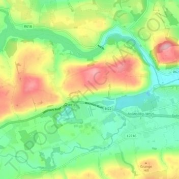
Name: Ovens topographic map, elevation, terrain.
Location: Ovens, Blarney - Macroom, County Cork, Munster, Ireland (51.86748 -8.71390 51.90629 -8.62219)
Average elevation: 71 m
Minimum elevation: 6 m
Maximum elevation: 176 m
Other topographic maps
Click on a map to view its topography, its elevation and its terrain.