
Charleston topographic map
Interactive map
Click on the map to display elevation.
About this map
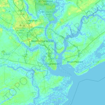
Name: Charleston topographic map, elevation, terrain.
Location: Charleston, Charleston County, South Carolina, United States (32.66851 -80.14385 32.97352 -79.79706)
Average elevation: 4 m
Minimum elevation: -5 m
Maximum elevation: 23 m
Other topographic maps
Click on a map to view its topography, its elevation and its terrain.
Palmetto Fort
United States > South Carolina > Charleston County > Mount Pleasant
Palmetto Fort, Mount Pleasant, Charleston County, South Carolina, 29466, United States
Average elevation: 4 m
Forest Lakes
United States > South Carolina > Charleston County
Forest Lakes, Charleston County, South Carolina, 29414, United States
Average elevation: 4 m
Garden Hill
United States > South Carolina > Charleston County > Charleston > Garden Hill
Garden Hill, Charleston, Charleston County, South Carolina, 29409, United States
Average elevation: 3 m