
Gaspereau Mountain topographic map
Interactive map
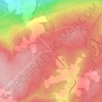
Click on the map to display elevation.
About this map
Name: Gaspereau Mountain topographic map, elevation, terrain.
Average elevation: 185 m
Minimum elevation: 45 m
Maximum elevation: 237 m
Other topographic maps
Click on a map to view its topography, its elevation and its terrain.
Davison Street
Canada > Nova Scotia > Municipality of the County of Kings > Forest Hill
Davison Street, Forest Hill, Municipality of the County of Kings, Kings County, Nova Scotia, B4P 2R1, Canada
Average elevation: 195 m