
Zlín topographic map
Interactive map
Click on the map to display elevation.
About this map
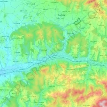
Name: Zlín topographic map, elevation, terrain.
Location: Zlín, okres Zlín, Zlínský kraj, Central Moravia, Czechia (49.16425 17.55981 49.29979 17.78662)
Average elevation: 312 m
Minimum elevation: 189 m
Maximum elevation: 653 m
Zlín is entirely located in the Vizovice Highlands. The highest point of the municipal territory is the top of the hill Tlustá hora with an elevation of 458 metres (1,503 ft).
Other topographic maps
Click on a map to view its topography, its elevation and its terrain.
Karolinka
Czechia > Central Moravia > Zlínský kraj
Karolinka, okres Vsetín, Zlínský kraj, Central Moravia, 756 05, Czechia
Average elevation: 656 m