
Roux topographic map
Interactive map
Click on the map to display elevation.
About this map
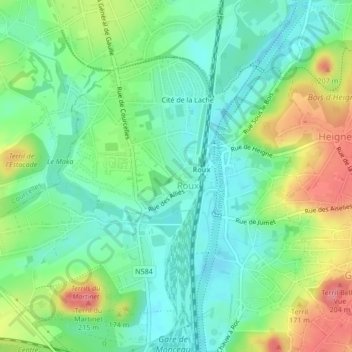
Name: Roux topographic map, elevation, terrain.
Location: Roux, Charleroi, Hainaut, Wallonia, 6044, Belgium (50.42524 4.36296 50.45814 4.40857)
Average elevation: 136 m
Minimum elevation: 103 m
Maximum elevation: 214 m
Other topographic maps
Click on a map to view its topography, its elevation and its terrain.