
Meredith topographic map
Interactive map
Click on the map to display elevation.
About this map
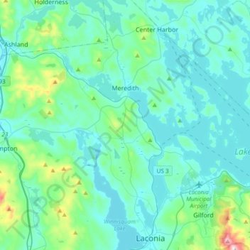
Name: Meredith topographic map, elevation, terrain.
Average elevation: 215 m
Minimum elevation: 142 m
Maximum elevation: 718 m
According to the United States Census Bureau, the town has a total area of 54.2 square miles (140.4 km2), of which 39.9 square miles (103.4 km2) is land and 14.3 square miles (37.0 km2) or 26.37% is water. The highest point in Meredith is the summit of Leavitt Mountain, elevation 1,414 feet (431 m) above sea level, in the southwestern part of town.