
Fedchenko Glacier topographic map
Interactive map
Click on the map to display elevation.
About this map
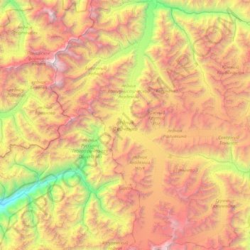
Name: Fedchenko Glacier topographic map, elevation, terrain.
Average elevation: 4,603 m
Minimum elevation: 2,186 m
Maximum elevation: 7,449 m
The glacier follows a generally northward path to the east of the 6,595 m (21,637 ft) Garmo Peak. The glacier begins at an elevation of 6,200 metres (20,300 ft) above sea level, and eventually melts and empties into the Balandkiik River near the border with Kyrgyzstan at an elevation of 2,909 metres (9,544 ft). Its waters eventually feed down the Muksu, Surkhob, Vakhsh, and Amu Darya rivers into the Aral Sea.