
Qujing topographic map
Interactive map
Click on the map to display elevation.
About this map
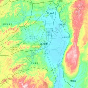
Name: Qujing topographic map, elevation, terrain.
Location: Qujing, Qilin District, Qujing City, Yunnan, China (25.33027 103.63654 25.65027 103.95654)
Average elevation: 2,019 m
Minimum elevation: 1,850 m
Maximum elevation: 2,440 m
Tempered by the low latitude and moderate elevation, Qujing has a mild subtropical highland climate (Köppen Cwb), with short, mild, dry winters, and warm, rainy summers. Frost may occur in winter but the days still generally warm up to around 15 °C (59 °F). During summer, a majority of the days features some rainfall, and daytime temperatures rise to 25 °C (77 °F). A great majority of the year's rainfall occurs from June to October.