
Kwiambal National Park topographic map
Interactive map
Click on the map to display elevation.
About this map
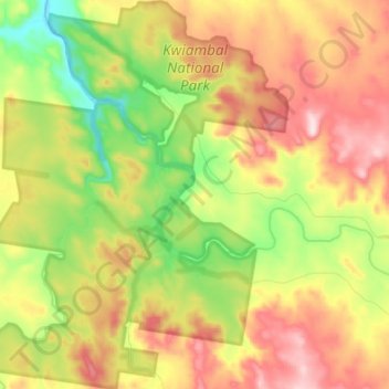
Name: Kwiambal National Park topographic map, elevation, terrain.
Average elevation: 430 m
Minimum elevation: 273 m
Maximum elevation: 601 m
Other topographic maps
Click on a map to view its topography, its elevation and its terrain.
Apple Tree Flat
Australia > New South Wales > Apple Tree Flat
Apple Tree Flat, Inverell Shire Council, New South Wales, Australia
Average elevation: 407 m