
Takengon topographic map
Interactive map
Click on the map to display elevation.
About this map
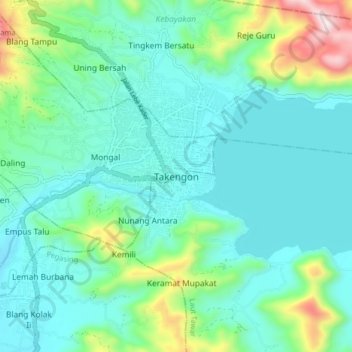
Name: Takengon topographic map, elevation, terrain.
Location: Takengon, Laut Tawar, Aceh Tengah, Aceh, Indonesia (4.58303 96.80886 4.66303 96.88886)
Average elevation: 1,346 m
Minimum elevation: 1,202 m
Maximum elevation: 1,900 m