
Cauca topographic map
Interactive map
Click on the map to display elevation.
About this map
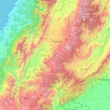
Name: Cauca topographic map, elevation, terrain.
Location: Cauca, Colombia (0.95857 -77.92795 3.32894 -75.74750)
Average elevation: 1,533 m
Minimum elevation: -1 m
Maximum elevation: 5,214 m
Other topographic maps
Click on a map to view its topography, its elevation and its terrain.