
Greater Monrovia topographic map
Interactive map
Click on the map to display elevation.
About this map
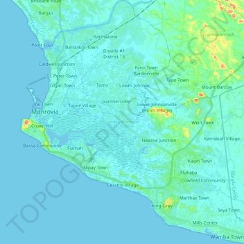
Name: Greater Monrovia topographic map, elevation, terrain.
Location: Greater Monrovia, Montserrado County, Liberia (6.21811 -10.81811 6.42057 -10.62259)
Average elevation: 7 m
Minimum elevation: -2 m
Maximum elevation: 75 m
Other topographic maps
Click on a map to view its topography, its elevation and its terrain.
Monrovia
Liberia > Montserrado County > Greater Monrovia
Monrovia, Greater Monrovia, Montserrado County, Liberia
Average elevation: 5 m