
Bad Schwalbach topographic map
Interactive map
Click on the map to display elevation.
About this map
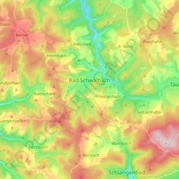
Name: Bad Schwalbach topographic map, elevation, terrain.
Location: Bad Schwalbach, Rheingau-Taunus-Kreis, Hesse, 65307, Germany (50.09500 7.95699 50.17806 8.10224)
Average elevation: 422 m
Minimum elevation: 253 m
Maximum elevation: 621 m