
Casteggio topographic map
Interactive map
Click on the map to display elevation.
About this map
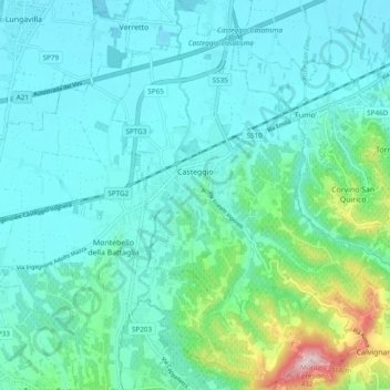
Name: Casteggio topographic map, elevation, terrain.
Location: Casteggio, Pavia, Lombardy, 27045, Italy (44.97609 9.10285 45.04384 9.16647)
Average elevation: 125 m
Minimum elevation: 65 m
Maximum elevation: 416 m