
Watheroo topographic map
Interactive map
Click on the map to display elevation.
About this map
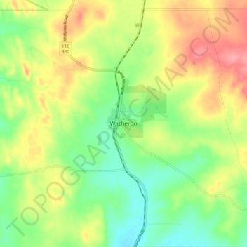
Name: Watheroo topographic map, elevation, terrain.
Average elevation: 283 m
Minimum elevation: 239 m
Maximum elevation: 340 m
Other topographic maps
Click on a map to view its topography, its elevation and its terrain.
Watheroo National Park
Australia > Western Australia > Watheroo
Watheroo National Park, Watheroo, Shire Of Moora, Western Australia, 6513, Australia
Average elevation: 258 m