
Morangup topographic map
Interactive map
Click on the map to display elevation.
About this map
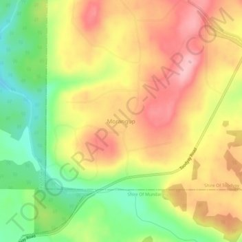
Name: Morangup topographic map, elevation, terrain.
Location: Morangup, Western Australia, Australia (-31.71526 116.28239 -31.67526 116.32239)
Average elevation: 312 m
Minimum elevation: 235 m
Maximum elevation: 377 m
Western Australia trails, hiking, mountain biking, running and outdoor activities