
Clyde Hill topographic map
Interactive map
Click on the map to display elevation.
Clyde Hill
The top elevation is close to 375 feet. There are approximately 21 miles of public roadway that make Clyde Hill very centrally located within the Seattle - Bellevue metro area.
About this map
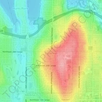
Name: Clyde Hill topographic map, elevation, terrain.
Average elevation: 48 m
Minimum elevation: 0 m
Maximum elevation: 118 m