
Greta Valley topographic map
Interactive map
Click on the map to display elevation.
About this map
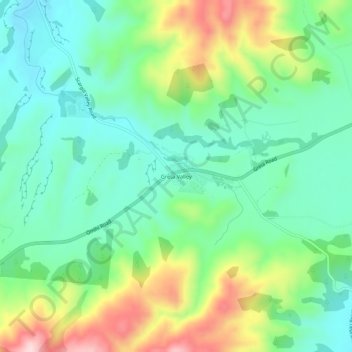
Name: Greta Valley topographic map, elevation, terrain.
Location: Greta Valley, Hurunui District, Canterbury, New Zealand (-42.98403 172.94829 -42.94403 172.98829)
Average elevation: 235 m
Minimum elevation: 132 m
Maximum elevation: 452 m