
Taha’a topographic map
Interactive map
Click on the map to display elevation.
About this map
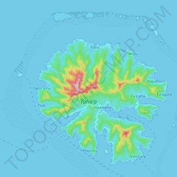
Name: Taha’a topographic map, elevation, terrain.
Location: Taha’a, Îles Sous-le-Vent, Polynésie française, France (-16.71098 -151.56933 -16.55486 -151.41190)
Average elevation: 34 m
Minimum elevation: -1 m
Maximum elevation: 556 m