
Hạ Long City topographic map
Interactive map
Click on the map to display elevation.
About this map
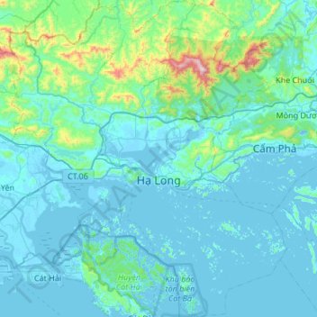
Name: Hạ Long City topographic map, elevation, terrain.
Location: Hạ Long City, Quang Ninh Province, Vietnam (20.72506 106.88547 21.03320 107.30225)
Average elevation: 23 m
Minimum elevation: -38 m
Maximum elevation: 423 m
Other topographic maps
Click on a map to view its topography, its elevation and its terrain.
La Raine
Vietnam > Quang Ninh Province > Ha Long
La Raine, Ha Long, Hạ Long City, Quang Ninh Province, Vietnam
Average elevation: 0 m