
Nanga topographic map
Interactive map
Click on the map to display elevation.
About this map
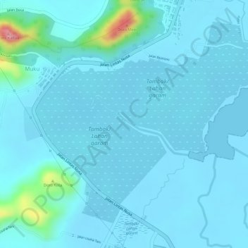
Name: Nanga topographic map, elevation, terrain.
Location: Nanga, Bima, Kabupaten Bima, West Nusa Tenggara, Indonesia (-8.55022 118.63375 -8.54352 118.64802)
Average elevation: 14 m
Minimum elevation: -1 m
Maximum elevation: 140 m
Other topographic maps
Click on a map to view its topography, its elevation and its terrain.
Nanga
Indonesia > West Nusa Tenggara > Bima
Nanga, Bima, Kabupaten Bima, West Nusa Tenggara, Indonesia
Average elevation: 22 m