
Lago Umayo topographic map
Interactive map
Click on the map to display elevation.
About this map
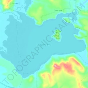
Name: Lago Umayo topographic map, elevation, terrain.
Location: Lago Umayo, Atuncolla, Provincia de Puno, Puno, Perú (-15.77643 -70.22674 -15.71160 -70.14068)
Average elevation: 3,875 m
Minimum elevation: 3,826 m
Maximum elevation: 4,139 m
Other topographic maps
Click on a map to view its topography, its elevation and its terrain.
Sillustani
Sillustani, PU-1047, Atuncolla, Puno, Perú
Average elevation: 3,858 m