
Kafue River topographic map
Interactive map
Click on the map to display elevation.
About this map
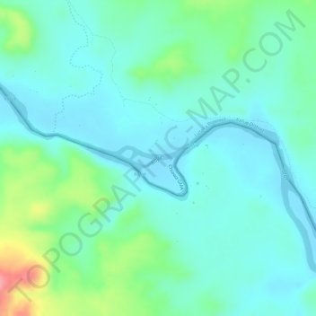
Name: Kafue River topographic map, elevation, terrain.
Location: Kafue River, Southern Province, Zambia (-15.90801 28.65989 -15.90652 28.66483)
Average elevation: 400 m
Minimum elevation: 374 m
Maximum elevation: 475 m
Other topographic maps
Click on a map to view its topography, its elevation and its terrain.
Moomba
Moomba, Namwala District, Southern Province, Zambia
Average elevation: 999 m
Victoria Falls
Zambia > Southern Province > Livingstone
Victoria Falls, Livingstone, Southern Province, Zambia
Average elevation: 875 m
Senkobo
Zambia > Southern Province > Senkobo
Senkobo, Livingstone District, Southern Province, Zambia
Average elevation: 1,103 m
Kazungula
Kazungula, Kazungula District, Southern Province, Zambia
Average elevation: 944 m
Livingstone
Livingstone, Livingstone District, Southern Province, Zambia
Average elevation: 961 m