
Rocky Cape National Park topographic map
Interactive map
Click on the map to display elevation.
About this map
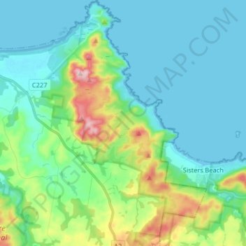
Name: Rocky Cape National Park topographic map, elevation, terrain.
Average elevation: 58 m
Minimum elevation: 0 m
Maximum elevation: 276 m
Other topographic maps
Click on a map to view its topography, its elevation and its terrain.
Sisters Beach
Australia > Tasmania > Sisters Beach
Sisters Beach, Tasmania, Australia
Average elevation: 61 m