
Roosevelt Island topographic map
Interactive map
Click on the map to display elevation.
About this map
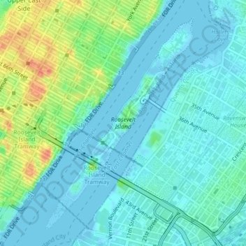
Name: Roosevelt Island topographic map, elevation, terrain.
Average elevation: 13 m
Minimum elevation: -6 m
Maximum elevation: 52 m
Other topographic maps
Click on a map to view its topography, its elevation and its terrain.
Sequoia Tree
United States > New York > New York County > New York
Sequoia Tree, Morningside Avenue, Manhattan Community Board 9, Manhattan, New York County, New York, 10027, United States
Average elevation: 19 m
Manhattan
United States > New York > New York County > New York
Manhattan, New York County, New York, United States
Average elevation: 16 m
Central Park
United States > New York > New York County > New York
Central Park, New York County, New York, United States
Average elevation: 26 m