
Hull River National Park topographic map
Interactive map
Click on the map to display elevation.
About this map
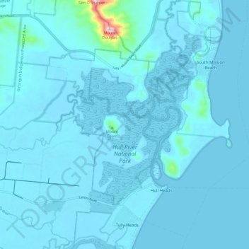
Name: Hull River National Park topographic map, elevation, terrain.
Average elevation: 14 m
Minimum elevation: -2 m
Maximum elevation: 329 m
Other topographic maps
Click on a map to view its topography, its elevation and its terrain.
Hull Heads
Australia > Queensland > Hull Heads
Hull Heads, Queensland, Australia
Average elevation: 5 m