
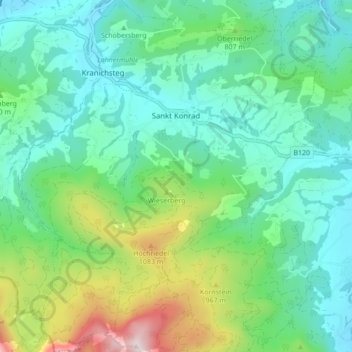
Sankt Konrad topographic map
Interactive map
Click on the map to display elevation.
About this map
Name: Sankt Konrad topographic map, elevation, terrain.
Location: Sankt Konrad, Gmunden, Upper Austria, 4817, Austria (47.87451 13.85071 47.93245 13.92605)
Average elevation: 734 m
Minimum elevation: 513 m
Maximum elevation: 1,388 m