
Hasseltbos topographic map
Interactive map
Click on the map to display elevation.
About this map
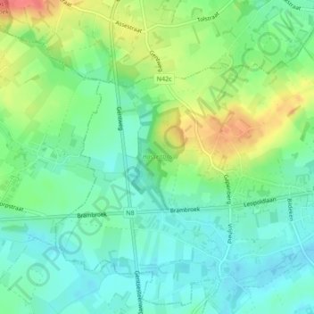
Name: Hasseltbos topographic map, elevation, terrain.
Average elevation: 45 m
Minimum elevation: 24 m
Maximum elevation: 83 m
Other topographic maps
Click on a map to view its topography, its elevation and its terrain.
Duivenbos
België > Vlaanderen > Herzele
Duivenbos, Duivenbosdreef, Sint-Antelinks, Herzele, Aalst, Oost-Vlaanderen, Vlaanderen, 9550, België
Average elevation: 57 m