
Gunung Jerai topographic map
Interactive map
Click on the map to display elevation.
About this map
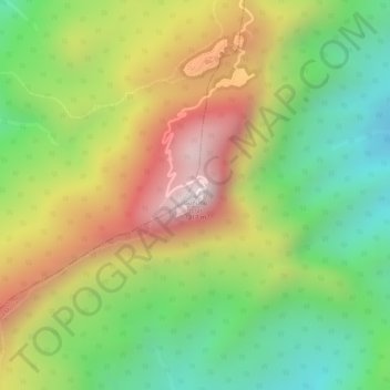
Name: Gunung Jerai topographic map, elevation, terrain.
Location: Gunung Jerai, Yan, Kedah, Malaysia (5.78722 100.43432 5.78732 100.43442)
Average elevation: 800 m
Minimum elevation: 475 m
Maximum elevation: 1,169 m
Other topographic maps
Click on a map to view its topography, its elevation and its terrain.
Kuala Nerang
Malaysia > Kedah > Kuala Nerang
Kuala Nerang, Padang Terap, Kedah, 06300, Malaysia
Average elevation: 32 m
Dulang Besar
Malaysia > Kedah > Dulang Besar
Dulang Besar, Yan, Kedah, 06900, Malaysia
Average elevation: 3 m