
Thank you for supporting this site ❤️
Make a donation
Make a donation
Gear up for your next adventure:
As an Amazon Associate, this site earns from qualifying purchases at no extra cost to you.
Airlie topographic map
Click on the map to display elevation.
Thank you for supporting this site ❤️
Make a donation
Make a donation
Gear up for your next adventure:
As an Amazon Associate, this site earns from qualifying purchases at no extra cost to you.
About this map
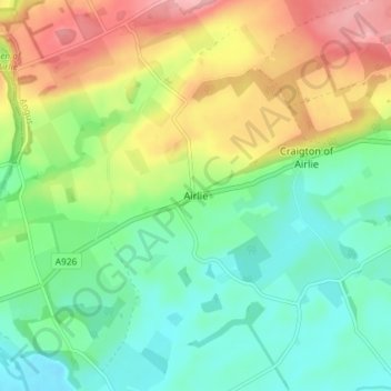
Name: Airlie topographic map, elevation, terrain.
Location: Airlie, Angus, Scotland, DD8 5NP, United Kingdom (56.61845 -3.13627 56.65845 -3.09627)
Average elevation: 91 m
Minimum elevation: 40 m
Maximum elevation: 176 m
Thank you for supporting this site ❤️
Make a donation
Make a donation
Gear up for your next adventure:
As an Amazon Associate, this site earns from qualifying purchases at no extra cost to you.