
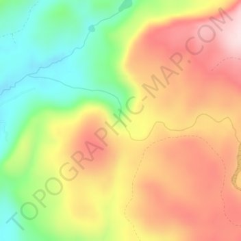
Cedar Creek Falls topographic map
Interactive map
Click on the map to display elevation.
About this map
Name: Cedar Creek Falls topographic map, elevation, terrain.
Average elevation: 440 m
Minimum elevation: 260 m
Maximum elevation: 610 m
Other topographic maps
Click on a map to view its topography, its elevation and its terrain.
East Renton Highlands
United States of America > Washington > East Renton Highlands > East Renton Highlands
Average elevation: 159 m
Clyde Hill
United States of America > Washington > Clyde Hill > Clyde Hill
The top elevation is close to 375 feet. There are approximately 21 miles of public roadway that make Clyde Hill very centrally located within the Seattle - Bellevue metro area.
Average elevation: 48 m
Clark County
United States of America > Washington
Many lakes border the river in the lowlands near Ridgefield, including Vancouver Lake. Eastern and northern Clark County contain forested foothills of the Cascade Mountains, rising to an elevation of 4,000 feet (1,200 m) on the border with Skamania County. Larch Mountain is the county's highest free-standing…
Average elevation: 266 m
Cheney
United States of America > Washington > Cheney
Cheney is located at 47°29′19″N 117°34′43″W / 47.48861°N 117.57861°W / 47.48861; -117.57861 (47.488634, -117.578581), at an elevation of 2,400 ft (730 m).
Average elevation: 725 m