Geolocate

Xinzheng topographic map

Interactive map

Click on the map to display elevation.

About this map

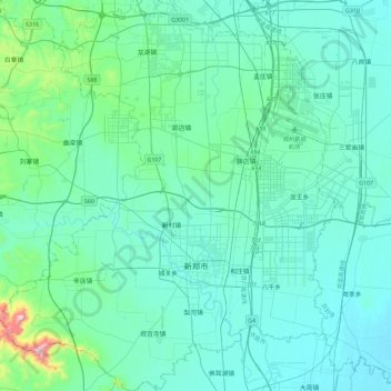
Name: Xinzheng topographic map, elevation, terrain.

Location: Xinzheng, Zhengzhou, Henan, China (34.27552 113.50471 34.65340 113.89991)

Average elevation: 151 m

Minimum elevation: 75 m

Maximum elevation: 764 m

Other topographic maps

Click on a map to view its topography, its elevation and its terrain.

Guangshan County

China > Henan

Guangshan County, Xinyang, Henan, China

Average elevation: 92 m

Zhengzhou

China > Henan

Zhengzhou, 金水区, Henan, China

Average elevation: 162 m

Zhongxin

China > Henan > Zhongxin

Zhongxin, Yucheng County, Shangqiu City, Henan, China

Average elevation: 45 m

Mamo

China > Henan > Mamo

Mamo, Huixian City, Xinxiang City, Henan, China

Average elevation: 525 m