
Mount Observation topographic map
Interactive map
Click on the map to display elevation.
About this map
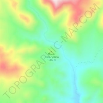
Name: Mount Observation topographic map, elevation, terrain.
Location: Mount Observation, Washoe County, Nevada, United States (41.04568 -119.36024 41.04578 -119.36014)
Average elevation: 1,580 m
Minimum elevation: 1,421 m
Maximum elevation: 1,854 m
Other topographic maps
Click on a map to view its topography, its elevation and its terrain.
Moapa Valley
United States > Nevada > Clark County
Moapa Valley is at an elevation of 1,265 ft (386 m) above sea level. The United States Census Bureau gives the census-designated place (CDP) of Moapa Valley (which may not coincide exactly with the town boundaries) a total area of 43.7 square miles (113.2 km2), of which 43.7 square miles (113.1 km2) is land…
Average elevation: 520 m
Carson City
Most of the city proper resides in the Eagle Valley. The Carson River flows from Douglas County through the southwestern edge of both the valley and Carson City. Since the consolidation, the city limits today include several small populated areas outside of this valley. Today the city limits include several…
Average elevation: 1,825 m
Reno
United States > Nevada > Washoe County
Reno is just east of the Sierra Nevada, on the western edge of the Great Basin at an elevation of about 4,400 feet (1,300 m) above sea level. Numerous faults exist throughout the region. Most of these are normal (vertical motion) faults associated with the uplift of the various mountain ranges, including the…
Average elevation: 1,650 m
Lincoln County
According to the U.S. Census Bureau, the county has an area of 10,637 square miles (27,550 km2), of which 10,633 square miles (27,540 km2) is land and 3.8 square miles (9.8 km2) (0.04%) is water. While only the third-largest county by area in the state of Nevada, it is the seventh-largest county in area in the…
Average elevation: 1,639 m
Clark County
The Colorado River forms the county's southeastern boundary, with Hoover Dam forming Lake Mead along much of its length. The lowest point in the state of Nevada is on the Colorado River just south of Laughlin in Clark County, where it flows out of Nevada into California and Arizona. Greater Las Vegas is a…
Average elevation: 968 m