
Aldinga Beach topographic map
Click on the map to display elevation.
About this map
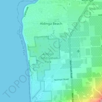
Name: Aldinga Beach topographic map, elevation, terrain.
Average elevation: 20 m
Minimum elevation: 0 m
Maximum elevation: 146 m
City of Onkaparinga trails, hiking, mountain biking, running and outdoor activities
Other topographic maps
Click on a map to view its topography, its elevation and its terrain.
Happy Valley Reservior
Australia > South Australia > City of Onkaparinga > Adelaide
Average elevation: 173 m
Port Noarlunga Reef Sanctuary Zone
Australia > South Australia > City of Onkaparinga > Adelaide
Average elevation: 1 m
Adelaide (Sellicks Hill) Weather Radar
Australia > South Australia > City of Onkaparinga > Adelaide
Average elevation: 291 m