
Eden Prairie topographic map
Interactive map
Click on the map to display elevation.
About this map
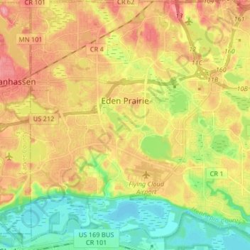
Name: Eden Prairie topographic map, elevation, terrain.
Location: Eden Prairie, Hennepin County, Minnesota, United States (44.79855 -93.52090 44.89226 -93.39837)
Average elevation: 259 m
Minimum elevation: 208 m
Maximum elevation: 313 m
In 1853, John H. McKenzie and Minnesota Territory secretary Alexander Wilkins platted the town of Hennepin along the Minnesota River in what is now southeastern Eden Prairie. According to area historian Helen Holden Anderson, topographic disadvantages for the transport of agricultural goods caused Hennepin to be eclipsed by other towns in the region, and the town soon vanished from maps.