
Thank you for supporting this site ❤️
Make a donation
Make a donation
Gear up for your next adventure:
As an Amazon Associate, this site earns from qualifying purchases at no extra cost to you.
Tatopani topographic map
Click on the map to display elevation.
Thank you for supporting this site ❤️
Make a donation
Make a donation
Gear up for your next adventure:
As an Amazon Associate, this site earns from qualifying purchases at no extra cost to you.
About this map
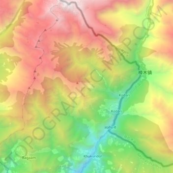
Name: Tatopani topographic map, elevation, terrain.
Location: Tatopani, Bhotekoshi, Sindhupalchowk, Bagmati Pradesh, Nepal (27.90584 85.87534 28.05310 85.97838)
Average elevation: 3,190 m
Minimum elevation: 1,307 m
Maximum elevation: 5,461 m
Thank you for supporting this site ❤️
Make a donation
Make a donation
Gear up for your next adventure:
As an Amazon Associate, this site earns from qualifying purchases at no extra cost to you.