
Badger Head topographic map
Interactive map
Click on the map to display elevation.
About this map
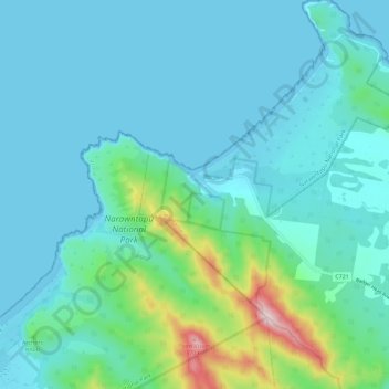
Name: Badger Head topographic map, elevation, terrain.
Location: Badger Head, West Tamar, Tasmania, Australia (-41.14858 146.65842 -41.06328 146.77174)
Average elevation: 58 m
Minimum elevation: 0 m
Maximum elevation: 384 m
Tasmania trails, hiking, mountain biking, running and outdoor activities