
Chongchuan District topographic map
Interactive map
Click on the map to display elevation.
About this map
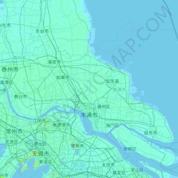
Name: Chongchuan District topographic map, elevation, terrain.
Location: Chongchuan District, Nantong City, Jiangsu, 226000, China (31.65818 120.19729 32.71467 121.97468)
Average elevation: 4 m
Minimum elevation: -3 m
Maximum elevation: 313 m