
Bellbrook topographic map
Interactive map
Click on the map to display elevation.
About this map
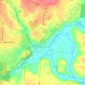
Name: Bellbrook topographic map, elevation, terrain.
Location: Bellbrook, Greene County, Ohio, 45305, United States (39.62069 -84.11178 39.65512 -84.05772)
Average elevation: 262 m
Minimum elevation: 228 m
Maximum elevation: 298 m
Other topographic maps
Click on a map to view its topography, its elevation and its terrain.
Wilberforce
United States > Ohio > Greene County > Wilberforce
Wilberforce, Xenia Township, Greene County, Ohio, 45384, United States
Average elevation: 297 m