
Mount Adelaide topographic map
Interactive map
Click on the map to display elevation.
About this map
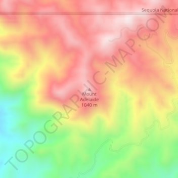
Name: Mount Adelaide topographic map, elevation, terrain.
Location: Mount Adelaide, Kern County, California, United States (35.43046 -118.74459 35.43056 -118.74449)
Average elevation: 841 m
Minimum elevation: 521 m
Maximum elevation: 1,079 m
Other topographic maps
Click on a map to view its topography, its elevation and its terrain.
Tehachapi
United States > California > Kern County
Tehachapi (/təˈhætʃəpi/ (listen); Kawaiisu: Tihachipia, meaning "hard climb")[9][10] is a city in Kern County, California, in the Tehachapi Mountains, at an elevation of 3,970 feet (1,210 m),[6] between the San Joaquin Valley and the Mojave Desert. Tehachapi is 35 miles (56 km) east-southeast of…
Average elevation: 1,414 m