
Elmhurst topographic map
Interactive map
Click on the map to display elevation.
Elmhurst
Due to local topography, the town has had a tendency to flood in the past after large rainfalls; the city is currently undertaking a large effort to mitigate future flooding.
About this map
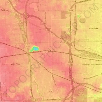
Name: Elmhurst topographic map, elevation, terrain.
Location: Elmhurst, DuPage County, Illinois, 60126, United States (41.73947 -88.10034 42.05947 -87.78034)
Average elevation: 210 m
Minimum elevation: 113 m
Maximum elevation: 292 m
Other topographic maps
Click on a map to view its topography, its elevation and its terrain.