
Federal Way topographic map
Interactive map
Click on the map to display elevation.
About this map
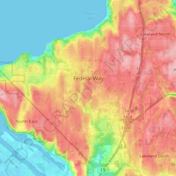
Name: Federal Way topographic map, elevation, terrain.
Location: Federal Way, King County, Washington, United States (47.25740 -122.41719 47.35795 -122.27347)
Average elevation: 81 m
Minimum elevation: -1 m
Maximum elevation: 163 m