
Bethungra topographic map
Interactive map
Click on the map to display elevation.
About this map
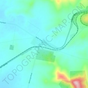
Name: Bethungra topographic map, elevation, terrain.
Location: Bethungra, Junee Shire Council, New South Wales, Australia (-34.78180 147.83652 -34.74180 147.87652)
Average elevation: 340 m
Minimum elevation: 291 m
Maximum elevation: 555 m
Other topographic maps
Click on a map to view its topography, its elevation and its terrain.
Ulandra Nature Reserve
Australia > New South Wales > Bethungra
Ulandra Nature Reserve, Back Tower Trail, Bethungra, Junee Shire Council, New South Wales, 2590, Australia
Average elevation: 510 m