
Condobolin topographic map
Interactive map
Click on the map to display elevation.
About this map
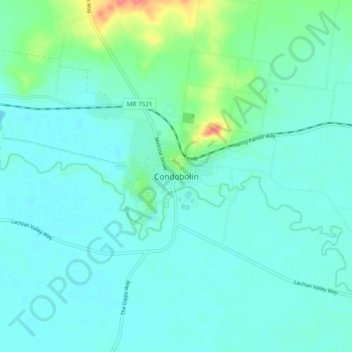
Name: Condobolin topographic map, elevation, terrain.
Average elevation: 197 m
Minimum elevation: 186 m
Maximum elevation: 248 m
Other topographic maps
Click on a map to view its topography, its elevation and its terrain.
Ghost Hill
Australia > New South Wales > Condobolin
Ghost Hill, Condobolin, Lachlan Shire Council, New South Wales, 2877, Australia
Average elevation: 252 m