
Milton topographic map
Interactive map
Click on the map to display elevation.
About this map
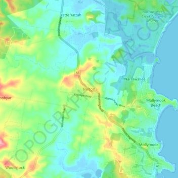
Name: Milton topographic map, elevation, terrain.
Average elevation: 32 m
Minimum elevation: -9 m
Maximum elevation: 130 m
Other topographic maps
Click on a map to view its topography, its elevation and its terrain.
Croobyar
Australia > New South Wales > Milton
Croobyar, Milton, Shoalhaven City Council, New South Wales, 2539, Australia
Average elevation: 72 m